7step how to monitor crop health using satellites
how to monitor crop health using satellites Farming has always relied on experience, intuition, and traditional field inspections. However, satellite crop monitoring is changing the game, offering farmers real-time insights into crop health, water stress, and potential diseases all without stepping into the field.
Farming has always relied on experience, intuition, and traditional field inspections. However, satellite crop monitoring is changing the game, offering farmers real-time insights into crop health, water stress, and potential diseases all without stepping into the field.
With advancements in remote sensing technology, satellites now provide high-resolution imagery that helps identify issues early, reducing losses and increasing yields. NDVI (Normalized Difference Vegetation Index) and other vegetation indices allow farmers to track plant growth, soil moisture levels, and overall crop development with incredible accuracy.
One of the biggest advantages of using satellite imagery in agriculture is its ability to cover large areas efficiently. Whether you’re a small-scale farmer or managing thousands of acres, satellite data helps optimize resources, minimize waste, and boost precision agriculture techniques.
As climate change and global food demand continue to rise, integrating satellite monitoring into farming practices isn’t just a smart move—it’s becoming essential. In the sections ahead, we’ll explore how farmers can easily use satellite technology to make more informed decisions and improve overall farm productivity.
How Satellites Track Crop Health: A Beginner’s Guide
Satellites play a crucial role in monitoring crop health by capturing high-resolution images of farmland. These images help farmers analyze plant growth, soil conditions, and potential threats like drought or disease.
A key tool in satellite crop monitoring is vegetation indices like NDVI (Normalized Difference Vegetation Index), EVI (Enhanced Vegetation Index), and SAVI (Soil-Adjusted Vegetation Index). These indices measure plant health, chlorophyll levels, and soil moisture, providing farmers with valuable insights for better crop management.
Satellites also detect water stress and plant diseases by analyzing temperature changes and reflectance patterns in crops. This allows early identification of drought-prone areas, pest infestations, and nutrient deficiencies.
Popular satellites used in agriculture include Sentinel-2, Landsat, and MODIS, which provide frequent and detailed farm data. By leveraging remote sensing technology, farmers can make smarter decisions, optimize resources, and increase yields with minimal effort.
How to Use Satellite Data for Better Crop Management
Using satellite crop monitoring effectively can help farmers improve yields, detect crop stress, and optimize resources. Here’s a step-by-step guide:

- How to Get Satellite Imagery for Your Farm
Farmers can access satellite data through platforms like Sentinel Hub, NASA’s Landsat Program, and commercial services. Many offer free satellite images for precision agriculture, helping growers monitor crop health in real time. - how to monitor crop health using satellites and Reports
By using NDVI maps and other vegetation indices, farmers can assess plant health, soil moisture, and disease risks. AI-driven analytics provide detailed insights into potential issues. - Actionable Steps for Farmers
- Adjust irrigation schedules based on water stress data.
- Identify low-yield areas and apply precision fertilization.
- Detect early signs of crop disease to prevent large-scale damage.
By integrating satellite remote sensing into farm management, growers can reduce costs, improve efficiency, and enhance sustainable agriculture practices.
Key Benefits of Satellite Crop Monitoring: How to Monitor Crop Health Using Satellites for Precision Farming
Farmers worldwide are turning to satellite crop monitoring to improve efficiency and maximize profits. Here’s how satellite technology in agriculture is transforming modern farming:
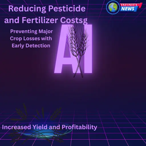
1. Increased Yield and Profitability
By analyzing NDVI satellite imagery for crop health, farmers can detect nutrient deficiencies, soil moisture levels, and plant stress in real time. This helps optimize fertilization schedules and improve overall crop productivity, leading to higher yields and better profitability.
2. Reducing Pesticide and Fertilizer Costs
With precision agriculture using remote sensing, farmers can apply pesticides and fertilizers only where needed. Satellite data helps identify problem areas instead of treating the entire field, significantly lowering input costs and environmental impact.
3. Preventing Major Crop Losses with Early Detection
Satellite imagery for disease detection in crops allows farmers to spot pest infestations, drought stress, and fungal infections before they spread. By taking quick action, farmers can prevent large-scale losses and ensure stable food production.
Embracing satellite-based agriculture leads to sustainable farming, resource efficiency, and long-term profitability.
Comparing Satellite Monitoring with Other Precision Farming Methods
With the rise of precision agriculture, farmers now have multiple technologies to monitor their crops. But how does satellite monitoring compare to drones and on-ground sensors? Let’s break it down.
Satellite vs. Drone Monitoring: Which is Better?
- Satellites provide large-scale coverage, making them ideal for monitoring large farms and tracking long-term crop health trends.
- Drones offer high-resolution images but require frequent flights, manual operation, and higher costs.
- Best Use: Satellites are better for regular monitoring, while drones are useful for spot-checking specific problem areas.
Remote Sensing vs. On-Ground Sensors: Pros & Cons
- Remote sensing (satellites & drones) provides a broader perspective but may be affected by cloud cover or weather conditions.
- On-ground sensors deliver real-time soil and crop data, but they are costly and require maintenance.
The Cost-Effectiveness of Satellite Technology
Free satellite imagery for crop monitoring is available through platforms like Sentinel Hub and Landsat, making it a budget-friendly precision farming tool compared to drones or IoT-based sensors. By integrating satellite data with other precision farming techniques, farmers can optimize resources, improve crop health, and maximize yields efficiently.
Overcoming Challenges in Using Satellite Data
While satellite crop monitoring offers many benefits, farmers often face challenges in accessing, interpreting, and relying on satellite imagery. Here’s how to overcome these hurdles.
1. How Farmers Can Access Free or Affordable Satellite Imagery
Many platforms provide free satellite imagery for precision agriculture, such as Sentinel-2, NASA’s Landsat, and MODIS. For higher-resolution images, affordable subscription-based services like PlanetScope and EOS Crop Monitoring are available.
2. Learning How to Interpret Satellite Images Without Expertise
Farmers without a technical background can use AI-powered precision farming tools that translate NDVI, EVI, and SAVI indices into easy-to-understand insights. Many agriculture monitoring software platforms offer automated crop health reports and recommendations.
3. The Impact of Weather and Cloud Cover on Satellite Monitoring
Cloud cover can obstruct optical satellite imagery, making it harder to track crop health in real time. To counter this, farmers can use radar-based satellite data (SAR technology), which penetrates clouds and provides consistent monitoring regardless of weather conditions. By leveraging free satellite data, AI-driven analytics, and radar imaging, farmers can maximize the benefits of remote sensing in agriculture.
The Future of Satellite Technology in Agriculture
As agriculture embraces digital transformation, satellite technology is set to play an even bigger role in precision farming. Here’s what the future holds:
1. AI-Powered Satellite Analytics for Smarter Farming
Artificial intelligence (AI) in satellite crop monitoring is revolutionizing how farmers analyze data. AI-driven tools can automatically detect crop diseases, predict yields, and optimize irrigation schedules using real-time satellite images. This makes precision agriculture more efficient and accessible for farmers worldwide.
2. How Satellite Data Will Shape Sustainable Farming
By tracking soil moisture, deforestation, and carbon footprints, satellite remote sensing in agriculture helps promote sustainable farming practices. With global concerns over climate change and resource conservation, satellites enable farmers to use fewer pesticides, reduce water waste, and improve soil health.
3. Emerging Trends in Global Satellite Monitoring for Agriculture
New technologies like hyperspectral imaging, radar-based monitoring (SAR), and nanosatellites are making agriculture satellite monitoring more precise and affordable. These advancements will enable farmers to detect crop stress earlier and improve food security on a global scale. With AI-driven insights and next-gen satellite data, the future of smart farming looks more promising than ever.
FAQs About Satellite Technology in Agriculture
1. How does satellite crop monitoring work?
Satellite crop monitoring uses remote sensing technology to capture images of farmland, analyzing factors like vegetation health, soil moisture, and crop stress through specialized indices like NDVI and SAVI.
2. Can small-scale farmers use satellite data?
Yes! Many platforms offer free satellite imagery for farmers, such as Sentinel-2 and Landsat, making it accessible even for small-scale and local farms.
3. What are the advantages of satellite monitoring over drones?
Satellites provide large-scale, frequent updates with no manual effort, while drones require regular operation and cover smaller areas. Both have their benefits, and many farmers use a combination of both.
4. Does cloud cover affect satellite data accuracy?
Yes, but radar-based satellites (SAR technology) can penetrate clouds, providing reliable crop health monitoring even in bad weather conditions.
5. How can satellite data improve precision farming?
By detecting early signs of disease, drought, and nutrient deficiencies, farmers can take targeted action to optimize irrigation, fertilization, and pest control, leading to higher yields and reduced costs.
Final Verdict: The Future of Farming is in the Sky
Satellite technology is revolutionizing precision agriculture, giving farmers the ability to monitor crop health, detect diseases early, and optimize resource usage like never before. With advancements in AI-driven satellite analytics, radar-based imaging, and hyperspectral sensors, farming is becoming more efficient, data-driven, and sustainable.
For farmers, embracing satellite crop monitoring means higher yields, lower costs, and improved sustainability. As satellite imagery becomes more affordable and accessible, even small-scale farms can benefit from remote sensing technology.
While challenges like weather interference and data interpretation exist, innovations in AI-powered farming tools and SAR (Synthetic Aperture Radar) technology are making satellite-based agriculture more reliable and actionable.
In the coming years, agriculture satellite monitoring will continue to play a crucial role in global food security, climate resilience, and smart farming. By leveraging satellite data, farmers can stay ahead of crop challenges, maximize productivity, and contribute to a more sustainable agricultural future.
For More information visit website